


 17 / 40


17
UNEP/GRID-Arendal | Annual Report 2001
| |
Section 2 | GRID-Arendal in review
•
•
•
•
•
Some interactive map themes:
Topography
Human impact
Population
density
Land cover
Protected areas
•
•
•
•
•
•
Ecoregions
Permafrost
Geology
Solar radiation
Precipitation
Soils
Oden, the Swedish icebreaker, sailed
the Arctic Ocean with GRID-Arendal
staff on board. Our staff observed
how Norway collected data for future
definition of marine boundaries
according to the UN Convention on
the Law of the Seas.
Arctic information on the Internet
The Arctic Internet portal was the first operational portal
that was launched as part of UNEP's main portal to envi-
ronmental information,
UNEP.Net. For more information go
to:
www.unep.net/arctic.
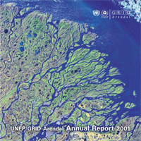
Access to information about how permafrost is responding
to rising temperatures is crucial when countries in the
Arctic will have to adapt to the impacts of global warming.
Many global and Arctic scientific programmes have
developed important datasets that now are being made
easily accessible through GRID-Arendal's new interactive
map service. This service provides easy access to, among
others, a map of the current extent of permafrost
(illustrated in blue). This map will act as a baseline of the
Arctic's frozen soils. To interact with the
maps, go to:
maps.grida.no/arctic ."I do not think it is radical to say that the
map will become progressively less blue in
the coming years"
, said Svein Tveitdal,
Managing Director of GRID-Arendal.
Photo
Halfdan Carstens