


 6 / 60

6
This synthesis report sources from three assessments
conducted by the Large Marine Ecosystems of the Canary,
Guinea and Benguela currents. The publications of these
separate assessments ranges in time from 2011 to 2015.
As this report aims to support sound decision making by
Member States to the Abidjan Convention, it is imperative
that attention be brought to new information and data that
has emerged since the source reports were completed.
An Addendum section was therefore added at the end of
this report to: present up-to-date figures on the value of
fisheries, tourism and regulating services; present updated
information on the status of fish stocks and contextual
information regarding marine activities and their link to the
African Integrated Maritime Strategy (AIM Strategy 2050).
1
The Addendum is not a comprehensive list as this would fall
outside the mandate of the current report. It does however
highlight the need for awareness of latest research and data
that can further support policy and decision making needs
in the region.
People living along the west, central and southern African
coast are directly dependent on the health of Large
Marine Ecosystems (LMEs) for sustenance, economic
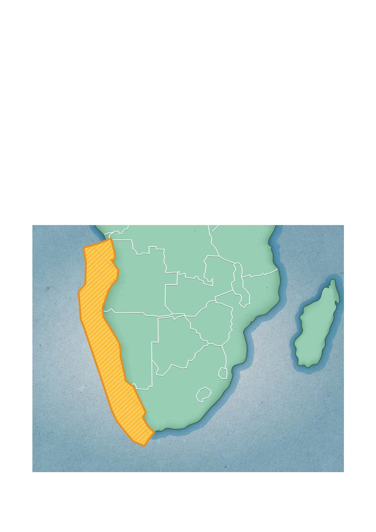
development and their way of life. The Benguela Current
LME (BCLME) stretches along the southwestern coast
(Figure 1a); the Guinea Current LME (GCLME) along central
Africa (Figure 1b); and the Canary Current LME (CCLME)
along north-western Africa (Figure 1c). The west, central
and southern African coastal populations’ well-being,
economies and cultures are interlinked with their ability
to properly govern and manage their own activity within
these ocean and coastal ecosystems. Over the last 30 years,
amid serious conflicts and extensive poverty, these coastal
communities, nations and regions have been unable
to effectively counteract rapid development, extensive
pollution growth, habitat loss and unsustainable use of
resources. They have missed opportunities to effectively
manage the highly productive ocean and coastal
ecosystems and to unlock the economic potential that
accompanies sustainable development.
2
Figure 1a:
The BCLME and bordering countries.
Source: International Waters Learning Exchange & Resource Network,
http://iwlearn.net/iw-projects/789/maps_graphics/benguela-current/view(accessed
August 1, 2016). Map data: Google Imagery, 2016 NASA, TerraMetrics.
Preamble
Introduction
Angola
Democratic Republic
of the Congo
Zambia
Namibia
Botswana
Tanzania
Mozambique
Zimbabwe
Madagascar
Swaziland
Lesotho
South Africa
South
Atlantic
Ocean