


 4 / 8
4 / 8

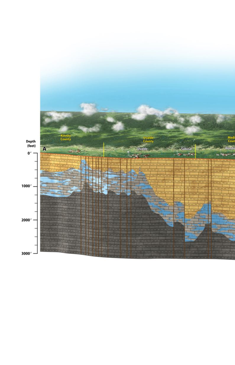
This generalized diagram of an east-west cross section of the Edwards Aquifer
region extends from Brackettville, in Kinney County, east, towards Kyle, in Hays
County. The Aquifer is illustrated in the confined zone (Artesian Zone) by the
relatively less permeable rocks above and below the Edwards Limestone.
The vertical lines represent some of the many seismic faults of the Balcones
Fault Zone. The faults formed approximately 18 million years ago causing
significant displacement within the Edwards Limestone.
Brackettville
Edwards Aquifer Regional Cross-Section