


 25 / 64


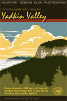
Experience Yadkin Valley’s
Outdoor Recreation
SCENIC
BIKEWAY
S
U
R
R
Y
C
O
U
N
T
Y
500miles of
S
URRY
S
CENIC
B
IKEWAY
bikewayswith
eight loops.
Drainage
Divide
Drainage
Divide
Drainage
Divide
Drainage
Divide
Drainage
Divide
Drainage
Divide
Drainage
Divide
Gage Sta.
SurryCountyParks&RecreationDept.
122HambyRd.,Dobson,NC 27017
336-401-8235
*
*
4
4
4
4
74
74
74
FUTURE
77
77
77
77
77
52
52
52
52
21
21
21
21
601
601
601
601
21
89
89
89
89
89
18
104
103
268
268
268
268
268
268
67
89
773
103
R
AVEN
K
NOB
S
COUT
CUMBERLANDKNOB
RECREATIONALAREA
Mitchell R.
Gamelands
Ronda
Elkin
Access
Access
Shoals
Access
Fisher River
Park Access
Donnaha
Access
Yadkin/
Shore
Access
Overmountain
Victory Trail
BLUE RIDGE PARKWAY
F
ISHER
M
OUNTAIN
Corridor
P
ILOT
M
OUNTAIN
Horne
Crk.Farm
E
LKIN
D
OBSON
M
OUNT
A
IRY
P
ILOT
M
TN.
J
ONESVILLE
S
TOKES
C
OUNTY
F
ORSYTH
C
OUNTY
Y
ADKIN
C
OUNTY
W
ILKES
A
LLEGHANY
C
OUNTY
G
RAYSON
C
OUNTY
C
ARROLL
C
OUNTY
P
ATRICK
C
OUNTY
C
OMMONWEALTH OF
V
IRGINIA
S
ALEM
Pilot
B
LUE
R
IDGE
P
ARKWAY
Exit1
Exit100
Exit93
Exit85
Exit83
Exit82
Exit11
Exit13
Exit141
N
M.P.
220
M.P.
225
3.5
Mi.
4.2
Mi.
4.0
Mi.
4.7
Mi.
3.4
Mi.
3.9
Mi.
2.3
Mi.
Ararat
River
Ararat
Fisher
Fisher
Little
Fisher
Mitchell
Yadkin
Yadkin
River
River
River
River
River
River
River
2421ft.
*
2.0
Mi.
*
*
6.7
Mi.
8.9
Mi.
*
*
*
89
R
IVER
P
ARK
S
TATE
P
ARK
67
S
ECTION
Trail
R
IVER
S
ECTION
67
6.9Mi.
5
to
6
268
601
268
21
C
OUNTY
5.0
Mi.
6.4
Mi.
1.3Mi.
6.1Mi.
2
to
3
6.8Mi.
1
to
2
Yadkin
River
Ararat
River
Toms
Crk.
Little
Yadkin
River
Pauls
Crk.
Stewarts
Creek
Little
Fisher
River
Fisher
River
South
Fork
S
ULPHUR
S
PGS.
F
LATROCK
B
ANNER-
TOWN
T
OAST
W
ESTFIELD
W
HITE
P
LAINS
A
RARAT
A
SH
H
ILL
L
EVEL
C
ROSS
C
OPELAND
Knob
S
HOALS
S
ILOAM
S
TONY
K
NOLL
R
OCKFORD
C
RUTCH-
FIELD
L
OW-
GAP
L
ADONIA
B
LEVIN’S
S
TORE
D
EVOTION
Z
EPHYR
M
OUNTAIN
P
ARK
T
HURMOND
Mitchell
River
D
OUGHTON
S
TATE
R
OAD
F
AIRVIEW
C
ROSSROADS
B
URCH
S
MITHTOWN
R
ICHMOND
H
ILL
S
HELTON
T
OWN
P
O
N
M
L
K
J
StonyKnoll
Vineyards
Jones
vonDrehle
Vineyards
andWinery
McRitchie
Old
North
State
Adagio
Carolina
Heritage
GrassyCreek
Herrera
Vineyards
JOLO
Vineyards
Hutton Vineyards
Round
Peak
Vineyards
Slightly
Askew
Shelton
Vineyards
Winery
Vineyards
Vineyard
andWinery
Winery
Vineyards
Winery and
Ciderworks
I
H
G
F
E
D
3
C
B
A
6
5
4
2
1
77
21
268
268
21
4
A
Slate
Mountain
Chestnut
Ridge
StonyRidge
Rock
State
Park22Mi.
Turner
Mtn.
Buck
Mtn.
Fulcher
Mtn.
Skull
Camp
Mtn.
Raven
Knob
Little
Mtn.
Len’s
Knob
Fisher
Peak
Cumberland
Knob
M.P.
219.9
M.P.
215
Saddle
Mtn.
R
ESERVATION
R
ONDA
B
OONVILLE
E
AST
B
END
Towns
/
Communities
Population:
Population:
Population:
4,000
to11,000
1,000
to3,000
400
to1,000
Unincor
p
orated
Highways
/
Roads
InterstateHighway
U.S.Highway
N.C.Highway
SecondaryRoute
BikeRoutes
SurryCo.ScenicBikeway
N.C.BikeRt.Four
N.C.Mountains-to-SeaTrail
(NorthLineTrace)
Winery
RiverAccess
TroutStream
CivilWarTrail
S
ILOAM
Exit100
Formore information,callSurry
Co.Parks&Rec.@336-401-8235
1234
Business
Business
Legend
Mtn-to-Sea
Trail
Thismap is for recreationalpurposes,andonly
RIVERACCESS
&existingonesclosedatany time
Tocheckon the latest status,visit:
http://yadkinvalleync.com/those roads incidental theretoare subject to
being shown.Whileeverye ortwasmade to
accuracy
isneithergauranteednor implied.
make thismapasaccurateaspossible,
absolute
Newaccessareasmaybeopened,
SurryCountyTroutWaters
(troutwaters shown darker)
DELAYEDHARVEST
HATCHERYSUPPORTED
Oct.1 to firstSat. in June.Only singlehook
Hatchery supported streamson theBlueRidgeParkway (BRP)
are stockedb
y
theN.C.WildlifeResourcesCommissionbut
are regulatedby theBlueRid
g
eParkway.Tocheck the
current regulations for theBRP,call336-373-8568.
No lureor size restrictions. 7 fishdaily
limit. Season -FirstSaturday inApril to
lastday inFebruary.
artificial lures;Nopossession.Allother
timeshatchery supported regulationsapply.
Crk.
Lovills
FisherPeakwasnamed forCol.
DavidFisher,amember of the
N.C.-Va. boundary survey party.
He is reputed to be buried there.
Parkway construction
beganonSept. 11,1935
Highest point inCarroll
andSurryCounties
Established in1954 to
serve theBoyScouts
ofnorthwestN.C.
TheupperMitchellhas
NorthCarolina’shighest
waterquality designation.
TabithaHolton, first female
lawyer in the southpracticed
inDobson from1878 to 1886
SurryCountywas
formed in 1771and
isnamed for the
English county
ofSurrey
TheFisherRiver
wasnamed forWm.
Fish,an early settler
In1847,ElkinMfg.Co.built amill onBig
ElkinCreek.During theCivilWar, it sup-
plied cloth forConfederateuniforms
andwas one of the few southernmills
to escapedestruction byUnion troops.
Rondawasnamed
for“Roundabout”-
anearby plantation
In 1872, the longestwooden
suspension bridge in the
worldwas built between
Elkin and Jonesville.
Rockfordwas the seatofSurry
Co. from1790 to1853.The county
seatmoved toDobsonafter the
territory south of the riverwas
ceded to formYadkinCounty
YadkinShoals/Islands
is arguably themost
beautiful andunique
section along theRiver
(seemap on back)
Ararat firstappears
on a 1755map by
Peter Jefferson father
ofThomas Jefferson
For informationabout
PilotMtn.Park, call:
336-325-2355, or visit
www.ncparks.govKnown tomillions of
AndyGriffith fansas
“MountPilot”
BirthplaceofAndy
Griffith, “Mayberry” is
alsohome of theworld’s
largestopen faced quarry
The state line alongSurryCo.was surveyed
considerably furthernorth than intended, and
hasmore angles than the restof theNorth
Carolina-Virginia boundary combined!
TomsCrk.
Ch.Rd.
Albion
Ch.Rd.
Epperson
Ch.Rd.
Athey
Simmons
Rd.
Cook
Sch.Rd.
Cook
Sch.Rd.
Cleo
CainRd.
OldWest-
eldRd.
JessupGrv.
Ch.Rd.
Armstrong
Rd.
Cook
Sch.Rd.
Chestnut
RidgeRd.
OldWest-
eldRd.
Old
U.S.52
Old
Winston
Road
TomsCrk.
Rd.
Shoals
Rd.
Shoals
Rd.
Perch
Rd.
Hauser
Rd.
Siloam
Rd.
Quaker
Ch.Rd.
Eldora
Rd.
Ararat
Rd.
LittleMtn.
Ch.Rd.
Radar
Rd.
Ararat-
Longhill
Rd.
Ararat
Rd.
Community
Bldg.Rd.
Old
U.S.52
Siloam
Rd.
Park
Dr.
Rockford
St.
Main
St.
ReevesMill
Rd.
Indian
GroveCh.
Rd.
Snody
Rd.
Quaker
Rd.
McBride
Rd.
W.
Lebanon
St.
Main
St.
Linv-
ille
Rd.
Slate
Rd.
Pipers
GapRd.
Red
BrushRd.
Red
BrushRd.
Simpson
MillRd.
OldU.S.
601
Siloam
Rd.
Siloam
Rd.
Turkey
FordRd.
Simpson
MillRd.
Siloam
Rd.
Copeland
Sch.Rd.
O.Rock-
fordRd.
Rockford
Rd.
BuckFork
Rd.
River-
SiloamRd.
Jenkins-
townRd.
MtHerman
Ch.Rd.
J.Layne
MillRd.
Rockford
Rd.
Main
St.
Prison
Rd.
Camp
MapleGrv.
Ch.Rd.
OldLow
GapRd.
OldLow
GapRd.
RoundPeak
Ch.Rd.
Hidden
ValleyRd.
Haystack
Rd.
Blevin’s
StoreRd.
Redhill
Crk.Rd.
Zephyr
Rd.
Kapps
MillRd.
Judsville
Sch.Rd.
Devotion
Rd.
Zephyr
Rd.
Zephyr-Mtn.
ParkRd.
Union
HillRd.
Haystack
Rd.
River
Rd.
Haystack
Rd.
Thurmond
Rd.
Mountain
ParkRd.
Poplar
Spg.Rd.
Dobbins
MillRd.
Twin
OaksRd.
Poplar
Spg.Rd.
Adams
Ridge
Rd.
C.Club
Dr.
Poplar
Spg.Rd.
2065
2072
2072
2070
2079
2048
2069
2048
2048
2061
2048
2053
2048
2024
Pop.1477
2012
2019
1815
1830
1809
2012
1815
1812
1822
1821
1815
1815
1809
1811
1811
1808
1780
1806
1807
1785
1786
1798
1789
1789
1794
1742
1717
1742
1758
1753
1774
0.7
Mi.
1815
2000
2119 2012
1774
2017
2026
2029
2022
2019
2038
2044
2080
1103
2080
2081
2230
2233
2221
2221
2209
2234
2221
2221
2200
2222
2209
2229
1103
1103
2221
1100
1100
2200
1100
1103
2200
2258
1103
1350
1350
2258
1544
1350
1396
1394
Pop.10,388
1624
1394
1640
1624
1625
1700
1701
1602
1602
1397
1618
1605
1396
1609
1397
1345
1345
1480
1480
1399
1345
1400
1341
1345
1340
1341
1347
1342
1346
1345
1343
1001
1342
1001
1100
1110
Pop.1586
1001
1122
1129
1122
1110
1121
1114
Pop.4001
1136
1134
1001
1133
1161
1301
1302
1301
1315
1315
1001
1322
1301
1328
1001
1330
1330
1334
1334
1333
1328
1338
1338
1330
1335
1331
1330
1330
1338
1331
1407
1338
1408
1408
1602
1600
1603
Main
St.
Old
U.S.52
Sauratown
Trail
Old
U.S.52
Perch
Rd.
Pinnacle
Exit
Mill
Rd.
S
p
a
i
n
h
o
u
r
Donnaha
Rd.
BlueRidge
MusicCenter
North Carolina
Welcome Center
Kapp’s
MillDam
FoxHunters
Paradise
Overlook
1302
2303
Pop.2285
Pop.417
1510
Rockford
Rd.
Richmond
HillCh.Rd.
Smith-
townRd.
Siloam
Rd.
ShadyGrove
Ch.Rd.
Shoals
Rd.
Smith-
townRd.
MainSt.
1527
1003
1003
1541
1546
Pop.1222
Pop.612
1.6
4.5
5.0
1.6
3.3
7.7
0.9
3.2
Siloam
Rd.
1003
1.9
4.4
2.5
3.4
3570 ft.
DanR.Basin
AraratR.Basin
AraratR.Basin
FisherR.Basin
FisherR.Basin
MitchellR.
Basin
2230
Historic
Rockford
Yadkin
Valley
R.R.
Hanging
W
HITE
Gage
Station
*
*
Burch
Access
5.0Mi.
3
to
4
16.7Mi.
4
to
5
Mountain
Park
Access
To StoneMountain
StatePark
Mtn-to-Sea
Trail
Mtn-to-Sea
Trail
Mtn-to-Sea
Trail
Mtn-to-Sea
Trail
Hamlin
Ford
Access
Bray
Ford
Access
268 E
Access
Station
*
*
*
*
*
*
*
*
*
*
*
*
*
*
*
*
*
*
HazeGray
Vineyards
(Undeveloped)
B
RiverAccess
(Developed)
Nelson
Rd.
Boyd
Edwards-Franklin
House
P
P
P
P
P
P
Mt.Airy-
PilotMtn.
Loop
Elkin-
Dobson
Loop
Mt.Airy-
PilotMtn.
Loop
Lowgap-
Mt.Airy
Loop
Mt.Airy-
West eld
Loop
Siloam
Conn.
Rockford
Conn.
Siloam
Conn.
Park
Spur
Alternate
Route
Alternate
Route
Alternate
Route
Lowgap-
Mt.Airy
Loop
Elkin-
Dobson
Loop
c
2
Fisher River • Stone Mountain • Yadkin River • Blue Ridge Parkway • Surry Scenic Bikeway
Mitchell River • Hanging Rock State Park • Ararat River • Pilot Mountain State Park
YadkinValleyNC.com