


 14 / 64


14
S T E M I N C U R R E N T E V E N T S
satellites for mapping and earthquake research. The financial
services industry uses GPS time signals to help move money
electronically.Hikers, cyclists, and other athletes use GPS signals
to record workouts and distances traveled. Of course, GPS can
also be used to
geo-tag
photos.
While there are lots of fun and productive ways to use your
smartphone’sGPS technology,scientists fromtheViennaUniversity
of Technology are using it in trying to end famine. The process
begins with GPS scans of the Earth’s surface in areas likely to
have drought and famine, such as the Central African Republic.
Microwave beams,which are a formof radiation like radio waves,
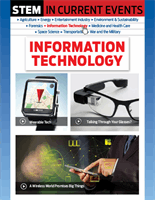
Computers at SATIDA collected data that included estimates of rainfall, land surface
temperature, soil moisture, and vegetation health to create this map of Ethiopia.