


 38 / 64


Republican River, flowing through the
south. In total, Nebraska has over
23,000 miles (37,000 km) of rivers,
streams, and canals. Most of its rivers
drain into the Missouri River.
Nebraska can be divided into two
main land regions: the Great Plains
and the Central Lowlands. Most of
Western Nebraska lies in the Great
Plains, the vast region of plains
stretching between the Mississippi
River and the Rocky Mountains. The
Central Lowlands make up the east-
ern fifth of the state.
This easternmost region is also
called the Dissected Till Plains. “Till”
refers to the rich sediment left behind
by the Ice Age glaciers that once cov-
ered this part of Nebraska. When the
glaciers melted, erosion from the run-
off water dissected, or cut, the land
into rolling hills and crisscrossing
streams. Much of eastern Nebraska is
farm country, but the state’s biggest
cities, Omaha and Lincoln, are also
located here.
The Great Plains region is sub-
divided into a number of smaller
sections with their own distinctive
features.
38
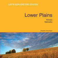
Lower Plains: Kansas, Nebraska
Sandhill cranes wade in the shallow Platte
River. The Platte and its tributaries (North and
South Platte) flow for more than 1,000 miles
(1,600 km).
Hilly fields planted with corn near Schuyler.
Eastern Nebraska is known for its fertile soil.