


 41 / 64


ble for days to the pioneers traveling
along the Oregon Trail in the mid-19th
century.
Toadstool Park in the northwest is
an area of
badlands
. Here, wind and
water have carved the landscape into
steep slopes and interesting shapes—
some even resembling toadstools, as
the name suggests. Many fossils have
been discovered in this area, including
fossils from a prehistoric species of
pig.
In the far southwestern corner of
the panhandle is Nebraska’s highest
natural point: Panorama Point. It has
an elevation of 5,426 feet (1,654 m)
above sea level. By contrast, the state’s
lowest point is in the far southeast of
the state, where the Missouri River
meets Nebraska’s border with Kansas.
There, the elevation is 840 feet (256
m) above sea level.
Nebraska’s panhandle is the driest
region of the state. It typically receives
less than 14 inches (36 cm) of rainfall
a year. The eastern part of the state
gets almost twice that amount of rain.
This explains why eastern Nebraska
41
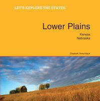
Lower Plains: Kansas, Nebraska
View of western Nebraska from Scott’s Bluff.