


 44 / 135

42
California Boating
A Course for Safe Boating
Chapter 2
u
Boating Law, Navigational Rules and Navigational Aids
NAVIGATIONAL AIDS
Like streets and highways, California waterways have navigation signs that
direct traffic. These navigation signs are called the U.S. Aids to Navigation
System, or ATONs. The U.S. Aids to Navigation System include lateral naviga-
tion markers, non-lateral markers and safe water aids.
ATONs Help Boaters:
Avoid problems
Travel safely
Navigate from one place to another
Locate their positions
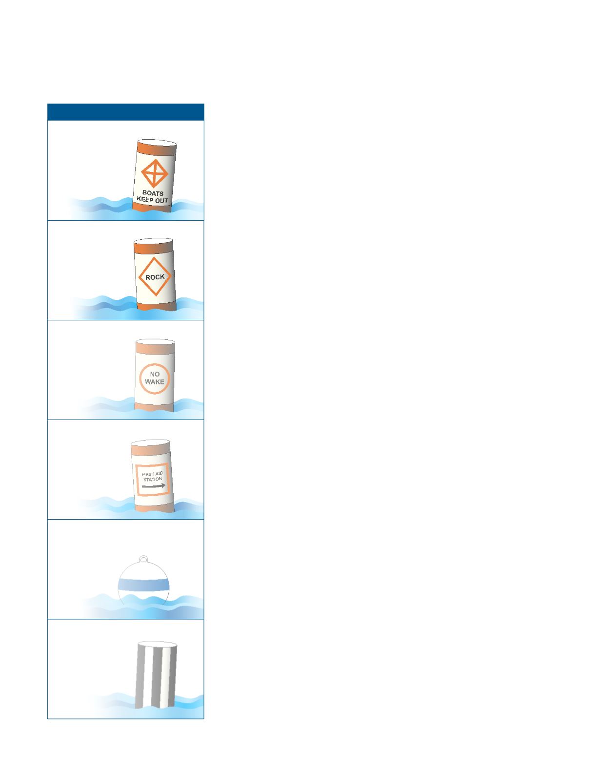
Non-Lateral Markers (State)
The Uniform State Waterways Marking System (USWMS) uses regulatory
markers and aids to navigation mostly on lakes and other inland waterways,
but may also be used on federal waters. The regulatory markers designate:
Boat exclusion areas:
A diamond shape with a centered cross designates
areas that boats must stay away from, such as swim areas, dams or
rapids. Wording may be placed outside the crossed diamond shape.
Danger:
An open-faced diamond identifies the nature of the danger, such
as rock, wreck or shoal (shallow area). Wording may be posted inside the
diamond shape.
Controlled area:
A circular shape designates a controlled area, and
wording may identify the type of control, such as “5 mph,” “no wake” or
“anchoring.” The warning may be placed inside the circle.
Information:
A square or a rectangle displays official information, such as
directions and locations.
A white mooring buoy with a blue band:
The buoy may show a white
reflector or light, and is for mooring only.
Inland waters obstruction mark:
A white buoy with black vertical stripes
indicates an obstruction to navigation. To avoid the obstruction, do not pass
between the buoy and the shore.
Buoys can be used to display regulatory markers. They may show a white light
and may be lettered.
Boat exclusion
area
Danger
Controlled
Information
Mooring
buoy
Inland waters
obstruction
mark
NON-LATERAL MARKERS