


 46 / 135

44
California Boating
A Course for Safe Boating
Chapter 2
u
Boating Law, Navigational Rules and Navigational Aids
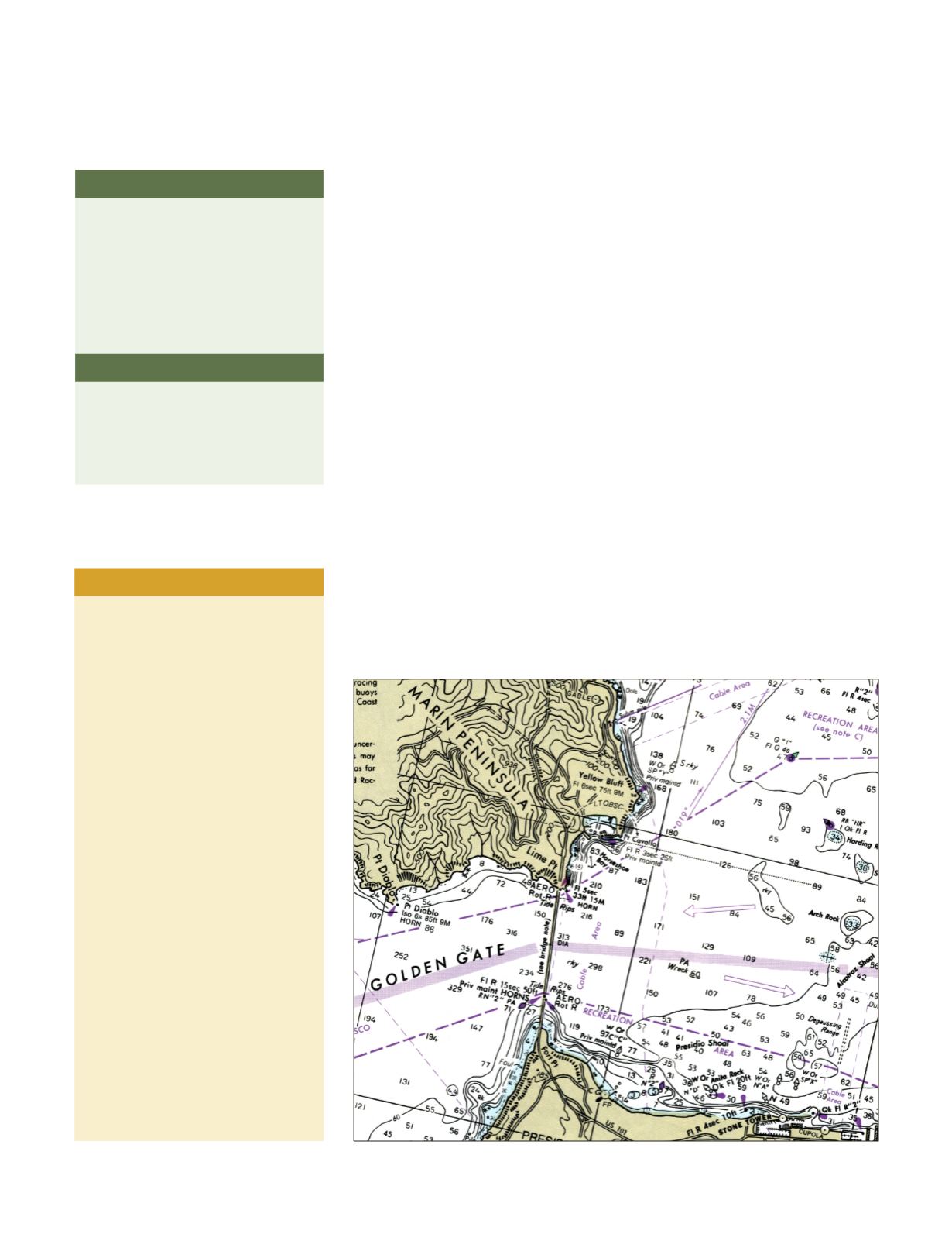
Navigational Charts
Navigational charts are available for the California coast, bays, and the
Sacramento-San Joaquin Delta (which includes the navigable portions of
the Sacramento and San Joaquin rivers). The main purpose of these charts
is to mark waterways for deep-draft vessels. These deep-water channels are
usually heavy boat traffic areas, and should never be used for anchoring or
recreation. Charts show shallow reefs, sandbars, and many other underwater
hazards. Boaters can also measure distances they wish to travel by using the
distance scale on the chart, or the degrees of latitude on either side of the
chart. The rule is one minute of latitude equals one nautical mile, no matter
where you are on the earth. You cannot use longitude as an accurate measure
of distance, because the scale changes with different locations around
the world.
Navigational charts are not available for many lakes and rivers because they
are not useful in waterways with extreme changes in water elevation, changes
in the shoreline, and areas that may have a lot of floating debris. In these
areas, boaters traveling in unknown waters should be extremely cautious and
try to learn about any hazards before boating.
In some charted waters, such as the Sacramento-San Joaquin Delta, recre-
ational boaters must be aware of changing waterways, because navigable
waters are affected by high volumes of rain, snow melt, and tides. In these
areas, floating debris and underwater obstacles can create extreme hazards.
WEBSITES
For electronic navigational charts,
visit the National Oceanic and
Atmospheric Administration (NOAA)
website
www.noaa.govU.S. Power Squadrons and the Coast
Guard Auxiliary offer courses on aids
to navigation.
For information about the U.S. Power
Squadrons, the course on aids to
navigation or other courses, visit
www.usps.orgFor information on the Coast Guard
Auxiliary and their courses, visit
www.cgaux.orgTo find out about coastal conditions
such as tides and currents, visit
www.dbw.ca.gov/TidesREMEMBER
Consider tides and tidal currents
when docking or mooring your boat,
when traveling through inlets or
narrow channels, and when
under way.
TAKE NOTE
The local knowledge you get at a
marina or bait shop can make your
boating trip safer.