


 46 / 100


46
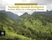
Transboundary collaboration in the Greater Virunga
The Greater Virunga Landscape is one of the most
biologically diverse mountainous landscapes in
the world containing three World Heritage Sites
(the Virunga, Rwenzori Mountain and Bwindi
Impenetrable National Parks), one Ramsar Site
(Lake George and Lake Edward) and one Biosphere
Reserve (Queen Elizabeth National Park). The
landscape, which covers an area of 15,155 km², has
been recognized as an area of global importance.
The Greater Virunga Landscape (GVL) provides
goods and services to local communities, and
contributes to the national economies through
different sectors such as tourism, agriculture,
energy and fisheries. The large and growing human
population of the area relies on the rich natural
capital. The Greater Virunga Landscape provides
millions of people with freshwater for drinking and
farming. However, overexploitation due to the high
population density (600 individuals per km², one of
the highest in the region) (Pavageau et al., 2013) has
had a severe effect on ecosystem services. In addition,
changes in climatic conditions have led to an increase
in extreme events such as floods and landslides, as
well changes in hydrological cycles, which affect
ecosystem services and the communities that depend
on them. Changes in mountain hydrology also have
consequences for downstream communities and are
likely to be highly significant to economic activities
dependent on this water (Beniston and Fox, n.d.).
Key challenges for Greater Virunga
The vulnerability of Greater Virunga to climate
change is related, to a large extent, to the
anthropogenic characteristics of the region such
as high levels of poverty; rapid population growth
and high population density; dependence on, and
overexploitation of, natural resources; as well as
the geophysical characteristics of this mountainous
landscape. This is exacerbated by the effects of
climate change which include water scarcity, falling
agricultural yields, erosion and floods. This, in
turn, affects food security in the region and could
increase poverty levels and dependency on natural
resources. Climate change also directly impacts on
biodiversity.
Climate change is already a reality in GVL and the
effects are being felt by communities experiencing
an increase in extreme natural events. This requires
a response from neighbouring countries to
develop and implement mitigation and adaptation
measures. This is hindered by weak coordination
and collaboration between the countries (including
the lack of harmonized policies, practices, and
priorities), inadequate information and information
management, the actions of extractive industries and
political instability.
Countries sharing the Greater Virunga ecosystems
face a number of specific challenges, including:
• A lack of vulnerability data and information. Some
research has been conducted but the findings are
not available to the public.
• Conflicts between the countries and the insecurity
in DRC impede collaboration. The presence of the
military camps in some areas of the landscape
does not allow access.
• There is a lack of communication between the
institutions and organizations operating in
the landscape which hampers transboundary
cooperation in tackling common issues.
• There is a limited number of local experts in the
regionwith an understanding of the local dynamics.
Agroforestry in the Virunga Mountains, Rwanda