


 20 / 30

A DECADE OF SUCCESSFULLY HELPING TO SECURE THE MARITIME RIGHTS OF DEVELOPING COASTAL STATES
20
Towards a New Map of theWorld
De ning the outer continental shelf
- from test of appurtenance to full submission
If
not enough
data: continue to Task 3
* there can be other reasons to make a partial submission
If
enough data
for some of the area: a partial submission*
can be written and lodged
If
yes
: next step, an internal Desktop study
If
no
: the outer most limit will automatically become 200 M
Task 1 - Does the continental margin extend beyond 200 M?
- Source data, utilising the One Stop Data Shop
- Identify specialist GIS software
- Analyse available data and develop possible ECS scenarios
- Determine if the available data supports the argument for ECS
- If more data is needed an acquisition plan can be developed
and costed
- Identify further required resources and funding sources
Task 2 - the Desktop Study
If
enough
data: the full submission can be written and lodged
- Re-analyse all data and examine the previously developed ECS
scenarios
- Determine if data is now su cient to support the argument for
ECS
Task 3 - Acquire data and incorporate it into the project
If
yes
: the full submission can be written and lodged, securing
a place in the queue for review by the CLCS
If
no:
go back to Task 2 (acquistion plan)
Completing a submission for ECS is a multi step process,
generally involving an initial assessment of potential ECS, fol-
lowed by a more comprehensive desktop study sometimes
highlighting the need for a data acquisition programme,
and finally the completion of the submission documents in
accordance with the Scientific and Technical Guidelines of
the CLCS.
The Shelf Programme team completed a worldwide scan-
ning assessment and desktop studies for states in the Pacif-
ic andWest Africa. It also produced preliminary information
documents (PIDs*) for states, furnishing them with the
*PIDs were submitted to the Secretary General of the United Nations
by developing states that were not in a position to complete a final
submission within the stipulated 10-year period, concluding in May
2009 for many states. The PID documents generally contain a morpho-
logical and geological description of the margin, preliminary informa-
tion indicating the limits of the outer continental shelf, a description
of the status of preparation and the intended date on which the final
submission will be made.
Defining the Extended Continental Shelf
completed document, or providing capacity building and
training for the states to produce their own PID.
The Shelf team also assistedWest African states with the
collection of geoscientific data. The data acquisition,
funded by the Norwegian Government, included the
deployment of six different types of seafloor and sub-sea-
floor imaging equipment and resulted in over 20,000 km of
survey information. In the Pacific the maritime boundaries
network, which includes the Shelf Programme, assisted
Papua New Guinea and the Cook Islands in designing data
acquisition programmes.
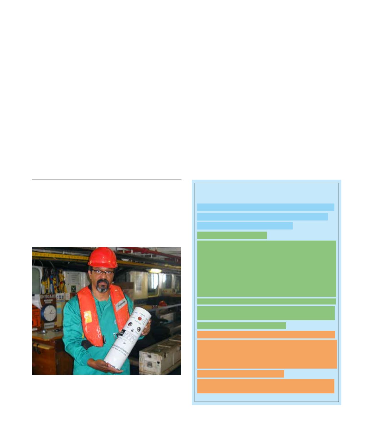
Professor António Filipe Lobo de Pina from Cabo Verde was
one of 8 observers from the West African States who joined the
boat during data acquisition in 2011/2012. Here he is holding
a Sonobuoy instrument.