


 24 / 30


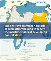
A DECADE OF SUCCESSFULLY HELPING TO SECURE THE MARITIME RIGHTS OF DEVELOPING COASTAL STATES
24
Participants at a workshop in the Seychelles in 2008 working on an ECS training project,
using the GEOCAP software to determine the base of slope and foot of slope points.
As the new global map of maritime jurisdiction takes
shape, there are still some States that are working on
submissions for ECS. These include States that are trans-
forming PIDs into full submissions and States that were
later signatories to UNCLOS* and so still have time to
make a submission.
It is essential that all States finish the job and permanent
maritime boundaries are established. Until finalised the
management of marine space and the development of
resources remains uncertain. Establishing ownership of
these areas and associated resources may be crucial for
the wellbeing and political stability of coastal States.
Until these “gaps in the world map” are closed, coastal
States may not be in a position to fully protect their inter-
ests or move forward with development plans.
* States that became a party to UNCLOS prior to 13 May 1999, had
until 13 May 2009 to make a submission. States that became a party
after 13 May 1999 have 10 years from the date of ratification to file
their submission. Similarly, states that lodged PIDs prior to 13 May
2009 have additional time to make a submission.
Closing the Gap
As the CLCS progresses in the review of the submis-
sions lodged so far, the first developing States to
lodge submissions are now starting to be assessed
and concrete outcomes of the capacity building and
technical assistance provided by the Shelf Programme
are beginning to be realised. The Commission has
finalised recommendations on the joint submission
of Mauritius and the Seychelles. The recommenda-
tions support the ECS boundary defined by the two
countries. This is a great result for two small island
nations and validates the role of the Shelf Programme
in providing data and technical capacity building.
Testing the submissions