


 430 / 822

ARCHAEOLOGY
Eternal India
encyclopedia
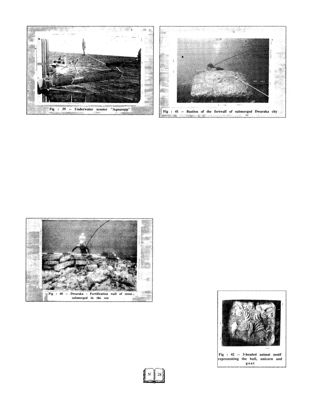
Sometimes underwater metal detector can be used for locating
objects within a range of 3 to 4 m from the instrument.
Lately two underwater scooters (Aquazepp) (fig: 39) have
been deployed for quick and efficient survey of a large city sub-
merged in the sea.
Submerged Dwaraka
The major discoveries 1.2 km seaward of Dwaraka are the inner
and outer fort walls of the city (fig:40) with a gateway complex
flanked by bastions (fig:41) built on a boulder-packing. The outer
gateway led to the sea and the inner one to the river Gomati. In all,
there are four enclosures two on each bank of the river. There are
traces of a stone jetty where ships used to be berthed. A few
flights of steps from the river, and what looks like a paved path in
the city are also recorded. The protection wall built of massive
dressed sand stone blocks are
in situ
upto 1 to 2 m height but the
buildings within built of smaller fraction blocks are all levelled up.
Thick vegetation and sediment were cleared before exploring the
submerged structures.
The discovery of pillars, beam and bases of flagposts suggests
the existence of a public building or temple and port installations.
Two cultural periods have been distinguished in Dwaraka as well
as Bet Dwaraka on the basis of ceramic, structural and stratigra-
phic evidence. The Thermoluminiscence date of pottery of Period I
is 3520 years Before Present (B.P.) and 1800-2000 years B.P. for
Period II. After Dwaraka of Period I was submerged about 1500
B.C. there was no occupation for almost 1000 years. A large
number of three-holed triangular anchors of sandstone and pris-
matic shaped ones have been found along the rocky ridge in the old
submerged channel of Gomati. At the extreme end about 1.5 km
there is a rocky ridge at 15 m water depth. Large prismatic stone
anchors with 3 holes are lying here. The man-made holes in the
ridge suggest that large ships were moored here, while the smaller
boats ferried in the channel.
The evidence from Bet Dwaraka is equally significant. The fort
wall extending in Sector BDKI (in patches) over 500m on the south
eastern shore of the island is dated 1500 B.C. on the basis of the TL
date of pottery from the site. Another wall of rubble found sub-
merged near the Central Sector of the eastern shore (BDK VIII) is
558m in periphery. Nearby are two rock-cut slipways for launch-
ing boats. In the northern sector at Balapur, also a small portion of
a submerged wall, could be traced. These two structures are visible
in lowest low water only, The ancient city in Bet Dwaraka seems to
have extended over a length of 4km. The proto-historic settlement
in Dwaraka is traced over an area of 1.5km. The submerged Gomati
channel widened and deepened gradually and perhaps joined the
sea about 1.5 km from the present shore. It carried heavier load of
water 3500 years ago, as indicated by the cutting in the rock.
Another channel south of the channel extending seaward of Gomati
ghat has come to light as a result of side scan sonar survey.
Antiquities
One of the most important finds from the underwater excavation
of Bet Dwaraka is a small seal of conch shell engraved with a 3-
headed animal motif representing the bull, unicorn and goat (fig :42)
A similar animal motif can be
seen on two seals one each
from
Mohenjo-Daro
and
Kalibangan. But the emaci-
ated body and exaggerated
eyes of the animals on the
Bet Dwaraka seal distin-
guish it from the Indus Valley
seals. The art style is more
akin to that of proto-historic
Bahrain with which Dwaraka
had trade and cultural con-
tacts in the 15th century B.C.