


 9 / 18

9
Spring 2017 Newsletter of the FCIAAO
COMMITTEE SPOTLIGHT ARTICLE—IT/GIS
needed for a through parcel review that would meet or exceed the PTO guidelines. We needed to com-
pare the improvement sketch and other data in our records with what was visible on our county’s GIS
mapping service or on Google Maps imagery, as it is more recent than the county ortho imagery. For
parcels obscured by foliage that could not be accurately reviewed using this desktop process and availa-
ble imagery, we needed to add a flag to indicate the parcel needs a physical inspection and an accompa-
nying note to describe what prevented the parcel review. After a week of online research and beta
testing, we had our first version of our very own Desktop Parcel Review product.
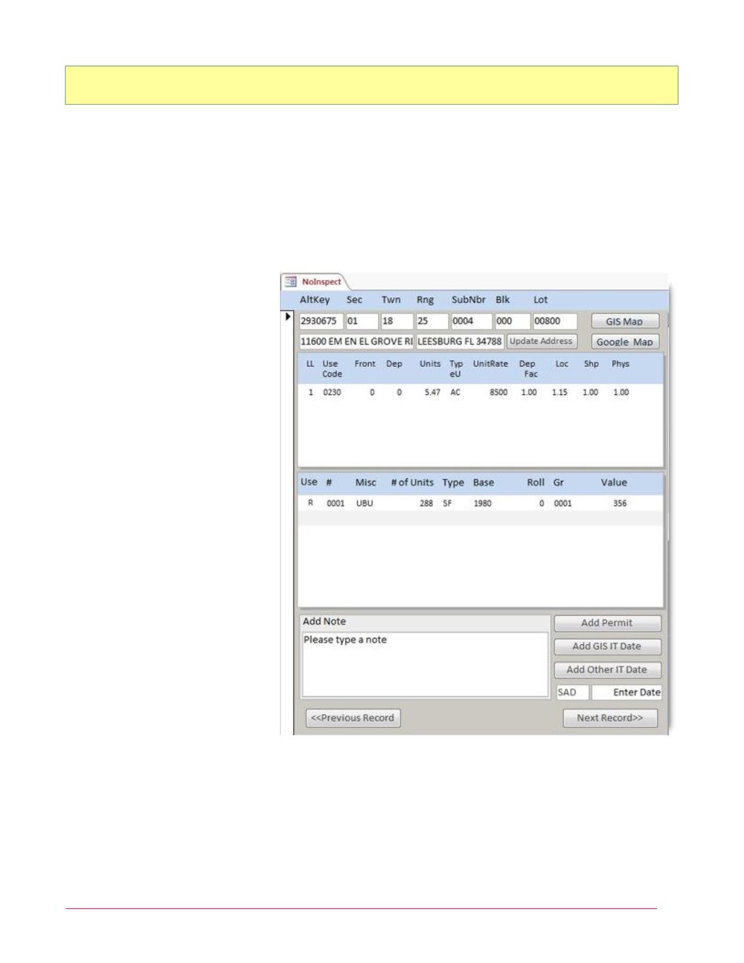
How does it work?
We designed the interface with
ease of use in mind. Simple
button clicks will provide the user
all required info. The user can
immediately view parcel infor-
mation such as:
Parcel Identifiers
Site Address
Land Information
Building Information
Miscellaneous Items
One of the first issues encoun-
tered was a way to display the
building information as Microsoft
Access doesn’t interpret our build-
ing sketch data. This was over-
come by using a web browser
within Microsoft Access to show
the property record card from our
website.
We also wanted a link to Google
Maps which presented our next
challenge; not all of the ‘out-of-
date’ parcels are improved parcels
with an address – vacant parcels must be reviewed too. The question was: how do we navigate to the
parcel on Google Maps with a single button click from our Access form? The solution was a Lat and
Long coordinate. We consulted with our GIS department to obtain each parcel’s latitude and longitude
then merged the coordinate data with our current CAMA data. We now have a way to navigate to and
review vacant parcels and confirm the building sketch and miscellaneous items of improved parcels uti-
lizing both our county’s GIS map and the Google Maps with a single click.