


 27 / 40


27
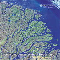
UNEP/GRID-Arendal | Annual Report 2001
| |
Section 2 | GRID-Arendal in review
Environmental information products
GRID-Arendal produces specialised products that help provide access to the best
available environmental information. Our technical expertise enables us to create
dynamic web sites, multimedia CD-ROMs and interactive maps and graphics, filled
with information on the latest environmental trends around the world.
Cartography and graphic design
In support to UNEP and other UN organisations, we help
transform statistical information and complicated texts into
understandable graphics.
In 2001 we created the layout for the International Panel
on Climate Change (IPCC)
Climate Change 2001 Synthesis
Report
and the
Global Methodology for Mapping Human
Impacts on the Biosphere
(GLOBIO) report, among others.
We produced more than 200 maps and graphics, which, in
one way or another, illustrated an environmental trend.
Subjects covered include climate change, poverty and
water management.
For The Global International Water Assessment (GIWA) we
made around 30-40 figures illustrating the report on the
State of the Environment of the Black Sea and the neigh-
bouring countries. Water pollution and eutrophication
(increase of nutrients in waterways) were the two main
features covered by this graphical exercise.
But it's with the IPCC working groups that the carto-
graphic studio of GRID-Arendal has given its most
extensive contribution. The cartographer in charge of the
presentation of the figures in the Climate Change 2001
report followed the working groups closely all over Europe.
He assisted the working groups in all stages of the
drafting, advising them on the best way to graphically
present the data. The resulting figures are now presented
in all major international climate change meetings.
One of the graphics that GRID-Arendal contributed to the IPCC Synthesis Report.