


 41 / 96


A GLOBAL OUTLOOK ON METHANE GAS HYDRATES
41
MALLIK Road
INUVIK-TUK Road
20 km
Beaufort Sea
Richards
Island
Inuvik
Mallik
Mackenzie
Delta
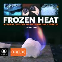
Figure 2.5:
The Mallik site in Canada’s Arctic. This has been the site of
dedicated gas hydrate programs since 1998. The map (above) shows
the route of the temporary ice road (red line) that provides access to the
site near the shore of the Mackenzie delta. The photo (below) shows
a sample of gas-hydrate-bearing coarse-grained sandstone recovered
from the site in 1998. (Courtesy: Geological Survey of Canada.)
Nankai Trough is a subduction zone where the Philippines
Sea Plate to the east is being overridden by the Eurasian Plate
to the west. This deep basin has collected thick sections of
sediment eroded from the Japanese Islands – including exten-
sive turbidite channel complexes and other sand-rich strata.
Exploration drilling conducted in the eastern Nankai Trough
in 1999 provided the world’s first confirmation of substantial
gas-hydrate-bearing sand reservoirs in a deep-water setting
(Tsuji
et al.
2004). Guided by a range of advanced geophysical
studies, additional drilling in 2004 permitted the delineation
of more than ten separate accumulations of gas hydrates in
deep-water sands (Tsuji
et al.
2009; Fujii
et al.
2009). The
reservoirs in the Nankai Trough are characterized by thick
sections of interbedded deep-water sands and muds (Takano
et al.
2007; Noguchi
et al.
2010) with individual gas-hydrate-
bearing sand layers typically less than a metre thick (Fujii
et
al.
2008; 2009).
Analysis of data acquired during the 2004 drilling and cor-
ing programs (Takahashi and Tsuji 2005) and associated
geophysical programs demonstrated that conventional oil
and gas data sets and concepts could be applied to the prob-
lem of deep-water gas hydrate detection and characterization
(Saeki
et al.
2008). Fujii
et al.
(2008) conducted an assess-
ment of gas hydrate resources in the most extensively stud-
ied area in the eastern Nankai Trough, an area estimated to
represent perhaps ten per cent of the total prospective area
for gas hydrates in waters around Japan. The assessment re-
vealed a mean estimate of gas-in-place of approximately 1.1
trillion cubic metres within a region totalling 7 000 square
kilometres, with 550 billion cubic metres occurring at high
concentrations in sand reservoirs. Kurihara
et al.
(2010) re-
ported numerical simulations of production potential and
determined that the technically recoverable portion of this
resource is likely large, constituting 50 per cent or more of
in-place resources, depending on production method and
location-specific geology. In 2012, Japan re-initiated drilling
and sampling activities in the Nankai Trough in preparation
for the first field trials (which began in 2013) of gas hydrate
production from a deep-water sand reservoir (Yamamoto
et
al.
2011). The 2013 drilling program included a rigorous re-
view of baseline environmental conditions and monitoring
of environmental impacts that might be associated with gas
hydrate production (Arata
et al.
2011).