


 15 / 74

13
STATE OF THE ENVIRONMENT IN THE RAET NATIONAL MARINE PARK (SOUTHERN NORWAY)
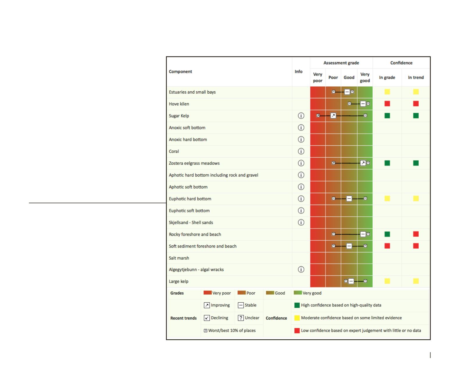
Figure 4:
Screen shot from the SOME web-based
software (appendix 1), showing a list of known or ex-
pected habitats in the Raet Park region, with scores
for condition (white boxes), trend (arrows or horizon-
tal line) and confidence (coloured squares) produced
using GRID-Arendal’s web-based system (appendix 1).
The solid black line represents the range in condition
scores from the worst 10 per cent to the best 10 per
cent for the specified habitat. See Table 1 (appendix
2) for grading statements used to derive the scores.
Scores were not provided for habitats where the ex-
perts considered there to be insufficient information
or evidence available to make an assessment. Hov-
ekilen is the name of an embayment within the Raet
Park (on Tromøy Island; Figure 1), commonly frequent-
ed by tourists and leisure boaters. The “i” symbol is a
weblink to text data entered by the rapporteur relevant
to the parameter and discussion of the experts.
During the workshop held for the present study, the
authors volunteered to participate in the subsequent
report-writing and thus self-nomination avoided any
conflict of interest. The results of the workshop are
as follows:
3.1 Habitats
Of the 17 habitats thought to potentially exist in the
Raet Park that were identified prior to the EE workshop
(Knutsenet al., 2010; Dahl et al., 2014), theparticipating
experts considered that there was sufficient evidence to
provide an assessment for only eight of them (Figure
4). The nine habitats not assessed were: anoxic soft
bottom; anoxic hard bottom; coral; aphotic hard bottom,
including rock and gravel; aphotic soft bottom; euphotic
soft bottom; shell sands; salt marsh; and algal wracks.
3. Results