


 6 / 110


6
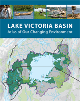
The Lake Victoria Basin covers 194,000 square
kilometres and its water resources comprise one of
the world’s greatest complexes of lakes, wetlands,
and rivers. Lake Victoria itself with a surface area of
68,000 square kilometres is the largest freshwater lake
in Africa. The lake basin plays major ecological, social
and economic roles in the East African Community
(EAC). It is the main source of water for domestic,
industrial, and hydro power generation. It is a climate
regulator, a reservoir of biodiversity and a medium
for transport.
The basin contributes significantly to nutrition and
food security through agricultural and fish production.
The Nile River, which flows out of Lake Victoria, is
an extremely important freshwater resource for
downstream countries of Ethiopia, South Sudan, Sudan
and Egypt. Of the estimated population of 150 million
people in the EAC region, about 40 million reside within
the Lake Victoria Basin. A large concentration of the
basin’s population lives along the lakeshore, including in
towns such as Mwanza, Entebbe and Kisumu.
The grasslands, wetlands, mountains, rainforests and
riverine areas are home to many species of plants and
animals. The lake basin is also a land of unparalleled
natural beauty. Its vast mineral and natural resources
provide immense opportunities for economic
development and human well-being. However,
increasing population and rapidly changing land-
use patterns are having profound effects on the local
environment. Sustaining high economic growth rates
needs to be matched with maintenance of the integrity
of environmental and natural resources in the Lake
Victoria Basin. It is therefore imperative to identify and
understand environmental challenges in Lake Victoria
and to provide decision- and policy-makers with a
scientific basis to guide the sustainable use of the
basin’s resources.
The Lake Victoria Basin Commission, in collaboration
with GRID-Arendal, developed this
Lake Victoria
Basin: Atlas of Our Changing Environment
as part of
Foreword
its mandate under the Protocol for the Sustainable
Development of the Lake Victoria Basin. The atlas
provides compelling evidence of the extent and
severity of the dramatic changes over the past
30 years on the Lake Victoria Basin’s environment due
to both natural processes and human activities.
The atlas is the rst major publication to depict
environmental change in Lake Victoria Basin using
satellite imagery. By telling a vivid, visual story of
the dramatic natural and human activities effects on
the Basin’s landscapes, it is a resource for remedial
action at local, national, and regional levels. The
satellite images show different types of environmental
change, including conversion of forests and the
loss or degradation of habitats, urban growth,
altered hydrology, degraded shoreline areas, mining
developments, and impacts of climate change.
The active participation of partner states and other
stakeholders signifies the importance attached to
this atlas, and their commitment to implement its
recommendations. Therefore, there is a need to
create more awareness and sensitize stakeholders
at all levels on the importance of the findings of this
atlas. Its content should be disseminated to a wide
audience in the partner states and beyond to enable
them to incorporate the findings into their activities,
decisions and policies. In line with the Protocol for the
Sustainable Development of the Lake Victoria Basin,
the Lake Victoria Basin Commission supports the
partner states to actively protect, conserve and where
necessary rehabilitate the basin and its ecosystems.
On my own behalf and that of the Lake Victoria
Basin Commission, I take this opportunity to thank
GRID-Arendal, Lake Victoria Basin Commission
staff and experts from the basin who spearheaded
the writing of this atlas. I urge all players in the lake
basin to support the implementation of the findings
by taking the first steps to implement the atlas’s
recommendations.
Thank you
Dr. Ally Said Matano
Executive Secretary
Lake Victoria Basin Commission