
5
1
Introduction
1.0 I
ntroduction
1.1 Purpose
The updated Transportation Plan for the Town of Morrisville is the foundation of the Town’s
transportation policies and projects, and provides additional guidance on best practices
for the design of roadways, transit facilities, and bicycle-pedestrian facilities and programs.
The Town has authority over streets that it owns (e.g., Town Hall Drive), but many streets
are owned and maintained by the North Carolina Department of Transportation (NCDOT)
(e.g., NC 54). However, the Town exercises additional authority during the development
review process for new, private developments.
The purpose of the Transportation Plan is to create a system of roads and pathways that not
only accommodate travel through and within the town, and also respect and enhance
adjacent land uses. The current Plan covers the period 2009 - 2035 and supersedes the
2002 Transportation Plan
with new standards, recommendations, and a complete over-
haul of approach and format.
1.2 Transportation Plan Format
The Plan focuses on three principal elements, for those riding in cars, taking public transit,
walking, or riding a bicycle:
•
The existing conditions that people experience as they travel in and around Morrisville
(Section Three);
•
A set of recommendations that evolves from the current transportation system to a
more efficient and safe network through a series of roadway widenings, new roadways,
bicycle lanes, public transit service, pedestrian, and intersection improvements (Section
Five); and
•
A set of design guidelines that complement existing engineering standards, and are to
be adhered to whenever possible and appropriate (Section Six).
1.3 Relationship to Other Town Planning Documents
As mentioned previously, this Transportation Plan is a significant update from the 2002
Transportation Plan. To prepare the current Plan, a number of other documents were re-
searched or consulted, including the following:
•
Morrisville’s Design and Construction Ordinance (2008);
•
Morrisville Town Center Plan (2007);
•
Morrisville Parks, Greenways, and Open Space Master Plan (2006); and
•
Various standard engineering texts, such as the Manual on Uniform Traffic Control De-
vices (MUTCD) and Highway Capacity Manual.
The
2009 Land Use Plan
is being adopted concurrently with the Transportation Plan. The
two documents were developed using the same methodology and public involvement
process, and share three identical sections (Section Two: Background; Section Four: Policy
Direction; Section Seven: Action Items). The Town created the plans concurrently in rec-
ognition of the interconnected nature of transportation and land use. By planning them
jointly, the Town has an opportunity to more effectively guide its future.
1.4 Transportation Plan Review and Update Process
The
2009 Transportation Plan
process was conducted from 2007 through 2009 and is the
product of work by citizens, the Plan Advisory Committee, the Planning and Zoning Board,
the Town Council, Town staff and consultants. The Land Use and Transportation Plans are
reviewed by both the Planning and Zoning Board and Town Council.
The
2009 Transportation Plan
was prepared with extensive citizen involvement. Consider-
able effort was made to ensure that people interested in participating in the plan review
and update process had the opportunity to do so. The public process involved at least 179
individuals with a broad geographic representation from different areas within the Town.
The Plan review process was accompanied by an ambitious community-involvement strat-
egy that provided ready access both to new information and to the process.
The process included three public workshops, conducted in October 2007, January 2008,
and March 2008, that were attended by over 80 attendees each. The public workshops
emphasized both information dissemination from staff and consultants as well as the active
participation of citizens. Each workshop featured a group exercise that allowed partici-
pants to share their views of the future Morrisville in a structured, engaged manner. The
workshops were heavily advertised via flyers, newsletter notices and the citizen email list-
serv. The latter two workshops were also advertised by postcards sent to all of Morrisville’s
6,700 households and businesses (see example at right).
In addition, a series of seven Plan Advisory Committee (PAC) meetings were conducted
to solicit in-depth input from committee members, who represented a broad spectrum of
the community leaders and stakeholders. Three focus group meetings were held to target
key groups that might not attend the larger meetings, including youth, residents of the
North Morrisville-Shiloh area, and transit users. A public survey was conducted from Janu-
ary through March 2008, garnering 180 responses. A project website available throughout
the planning process offered a way to find any meeting materials, the current schedule of
meetings and events, and a way to provide input via an online discussion board. A project
hotline was also available for citizens to leave comments or questions for project staff.
The public process integrated with a robust technical process, with each providing feed-
back to the other. While public safety, mobility, and accessibility sometimes trumped in-
dividual concerns, most of the recommendations in this Plan can be traced to the broad
concerns identified by the public. A more detailed description of public engagement in
the planning process appears in Appendix C.
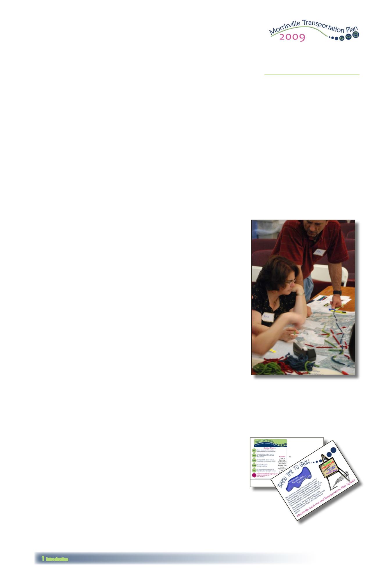
Citizens get involved in transportation
planning at the third public workshop,
held on March 27, 2008.
Postcard sent to
Morrisville households
advertising the March 27,
2008 public workshop.
Figure 1.1 on the opposite page offers
an overview of theTown of Morrisville,
showing color aerial photographs from
September 2007 and the planning
jurisdiction as a yellow dashed line.
The planning jurisdiction includes the
town limits as well as the town’s Extra
Territorial Jurisdiction (ETJ) (yellow
shading) and Short-Range Urban
Services Area (SRUSA) (orange shading)
and comprises the area subject to the
policies included in this plan document.
Although most of Morrisville’s planning
jurisdiction falls inWake County, several
parcels in Durham County have been
annexed into the town.


