


 9 / 125


│
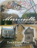
Town Center Plan
January 2007
Chapter 1: Existing Conditions
Overview
This chapter of the plan summarizes the
existing conditions in the project area. It
includes a description of themajor natural and
built features, as well as themarket conditions
that exist for potential new development in
this area. In summarizing these features,
this chapter also identifies a number of design
opportunities and challenges that were
identified and considered by participants in
the planning process.
Project Area
The Town Center lies at a natural and human
crossroads. Major physical characteristics
include creeks, floodplains, major roadways,
and a rail line, as well as parks and civic
facilities such as the Morrisville Town Hall
(see Map 1). The project area is divided into
a Core area comprised of about 340 acres,
centered around the historic crossroads at the
intersection of Church Street and Morrisville-
Carpenter Road, and a larger Boundary area
that totals 702 acres, including the Core area
(see Map 2).
The Town Center lies within the Neuse River
Basin near the ridge line with the Cape Fear
River Basin. Crabtree Creek passes along the
southern edge of the project area as it flows
east into Lake Crabtree.
Indian Creek and Sawmill Creek feed Crabtree
Creek from the north. Each of these streams
has a substantial floodplain. Altogether, a
total of about 20% (69 acres) of the Core
area is located in the floodway and the 100-
year floodplain.
The crossroads and rail line that helped
establish Morrisville as a community remain
major physical features of the Town Center
area. The rail line continues to serve as a
major corridor for freight traffic and passenger
service, and provides the future possibility for
Morrisville to once again have local passenger
service by train as it did in the period from
the 1850s to the 1930s. At the same time,
safety considerations with oncoming trains
have limited the number of at-grade crossings
allowed across the line, slowing automobile
travel, and creating a significant barrier to
bicyclists and pedestrians trying to move east
and west through the project area.
The high volume of automobile traffic along
Chapel Hill Road (NC 54), Aviation Parkway,
and Morrisville-Carpenter Road brings high
visibility to this part of town, as tens of
thousands of cars pass through it every day on
their way to and from Research Triangle Park,
Interstate 40, Raleigh-Durham International
Airport, and other destinations. At the same
time, the high traffic volume impedes access
to a number of destinations within the Town
Center, and impacts pedestrian safety. This
Crabtree Creek and its floodplain mark the southern
edge of the Town Center area. (Photo: Town of Mor-
risville)
The high volumes of traffic at the intersection of Chapel
Hill Road (NC 54) and Morrisville-Carpenter Road bring
both high visibility and access problems to the Town
Center. (Photo: S. Galloway, Town of Morrisville)