


 8 / 125

│
Town Center Plan
January 2007
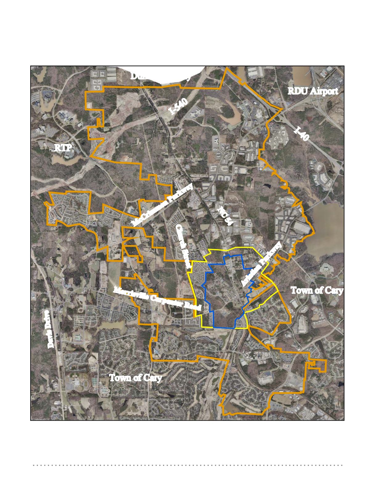
Map 1: Morrisville & Environs
RDU Airport
Town of Cary
Town of Cary
RTP
I-40
I-540
Durham County
Map 1:
This aerial photograph shows Morrisville’s central location in close proximity to Research Triangle Park,
Raleigh-Durham International Airport, Interstate 40, and Interstate 540. The orange line marks the Morrisville
town limits. The yellow line delineates the Town Center planning area. The blue line shows the Town Center Core.
(Photo: courtesy of Wake County)
Davis Drive
Morrisville Carpenter Road
McCrimmon Parkway
NC 54
Church Street
Aviation Parkway